Earth Observation of Global Change: The Role of Satellite Remote Sensing in Monitoring the Global Environment
2008th Edition
by Emilio Chuvieco (Editor)
Global Change is increasingly considered a critical topic in environmental research. Remote sensing methods provide a useful tool to monitor global variables, since they provide a systematic coverage of the Earth’s surface, at different spatial, spectral and temporal resolutions. This book offers an analysis of the leading missions in global Earth observation, and reviews the main fields in which remote sensing methods are providing vital data for global change studies.
Earth Observation of Wildland Fires in Mediterranean Ecosystems
2009th Edition, Kindle Edition
by Emilio Chuvieco (Editor) Format: Kindle Edition
Wildland fires are becoming one of the most critical environmental factors affecting a wide range of ecosystems worldwide. In Mediterranean ecosystems (including also South-Africa, California, parts of Chile and Australia), wildland fires are recurrent phenomena every summer, following the seasonal drought. As a result of changes in traditional land use practices, and the impact of recent climate warming, fires have more negative impacts in the last years, threatening lives, socio-economic and ecological values. The book describes the ecological context of fires in the Mediterranean ecosystems, and provides methods to observe fire danger conditions and fire impacts using Earth Observation and Geographic Information System technologies.
Forest Cover Change Detection and Fire Risk Susceptibility Analysis: An integrated approach of GIS and Remote Sensing for forest Change detection and fire risk analysis
Paperback – June 10, 2010
by Genanaw Alemu (Author)
Forest of the world is under serious threat owing to deforestation and fire. It is vital to understand the extent and pattern of deforestation to devise strategies before the problem results in massive environmental impact. On top of this identifying the degree of susceptibility of the forest to forest fire is also plays the same role. However, determining the extent and pattern of deforestation and identifying the level of susceptibility of the forest to fire is challenging by traditional approach. Thus, this book provides a technique to determine the extent, pattern and rate of deforestation. Moreover, it provides a method to analyze the degree susceptibility of the forest to forest fire. Although fire is one of the devastating factors for most vegetation,surprisingly it creates favorable condition for ericaceous vegetation of Ethiopian highland. The analysis in this book provides help to utilize GIS and remote sensing for forest fire susceptibility analysis, cover change detection and land cover pattern analysis. Particularly it offers useful information to professionals in GIS and remote sensing ,forestry, and agriculture fields.
Geographic Information and Cartography for Risk and Crisis Management: Towards Better Solutions
(Lecture Notes in Geoinformation and Cartography) 2010th Edition
by Milan Konecny (Editor), Sisi Zlatanova (Editor), Temenoujka L. Bandrova (Editor)
(Lecture Notes in Geoinformation and Cartography) 2010th Edition
by Milan Konecny (Editor), Sisi Zlatanova (Editor), Temenoujka L. Bandrova (Editor)
Global and Regional Vegetation Fire Monitoring from Space: Planning a Coordinated International Effort
Paperback – July 20, 2001
by F.J. Ahern (Author), J.G. Goldammer (Author), C.O. Justice (Author)
Paperback – July 20, 2001
by F.J. Ahern (Author), J.G. Goldammer (Author), C.O. Justice (Author)
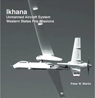
Ikhana: Unmanned Aircraft System Western States Fire Missions
(The NASA History Series) Paperback – November 3, 2013
In 2006, NASA Dryden Flight Research Center, Edwards, Calif., obtained a civil version of the General Atomics MQ-9 unmanned aircraft system and modified it for research purposes. Proposed missions included support of Earth science research, development of advanced aeronautical technology, and improving the utility of unmanned aerial systems in general. The project team named the aircraft Ikhana – a Native American Choctaw word meaning intelligent, conscious, or aware – in order to best represent NASA research goals. Researchers at Dryden have a long history of using remotely piloted research vehicles to expand the frontiers of knowledge. Among the first was the Hyper III, a Langley-designed lifting body. In 1975 a series of stall and spin tests was begun at the center with a group of 3/8-scale F-15 RPRVs. Flights of another aircraft, dubbed the “Mini-Sniffer,” took place between 1975 and 1979, testing the concepts of an RPRV operating in the Martian atmosphere or conducting high-altitude atmospheric research around the globe. The DAST – Drones For Aerodynamic and Structural Testing – program, a high-risk flight experiment using a ground-controlled, pilotless aircraft, was undertaken at Dryden from 1977 to 1983. Described by NASA engineers as a “wind tunnel in the sky,” the DAST vehicle was a specially modified Teledyne-Ryan BQM-34E/F Firebee II supersonic target drone. From 1979 to 1983 the HiMAT (Highly Maneuverable Aircraft Technology) aircraft was flown, one of two subscale research vehicles meant to demonstrate advanced fighter technologies that have since been used in development of many modern high-performance military aircraft. In 1984 Dryden moved from small-scale vehicles to full-size aircraft when a pilot intentionally crashed a retired Boeing jetliner onto Rogers Dry Lake to test a compound meant to reduce post-crash fires on airliners. And Dryden was the center for operations of a family of solar-powered aircraft designed to explore the potential for such aircraft to monitor Earth’s atmosphere as well as such other factors as moisture content in soil. Beginning in the 1990s, Pathfinder, Pathfinder-Plus, and Helios were all part of the Environmental Research Aircraft and Technology, or ERAST, program through which researchers hoped to mature RPRV and unmanned aerial system technologies. Building on experience with these and other unmanned aircraft, NASA scientists developed plans to use the Ikhana for a series of missions to map wildfires in the western United States and supply the resulting data to firefighters in near-real time. A team at NASA Ames Research Center, Mountain View, Calif., developed a multispectral scanner that was key to the success of what became known as the Western States Fire Missions. Carried out by team members from NASA, the U.S. Department of Agriculture Forest Service, National Interagency Fire Center, National Oceanic and Atmospheric Administration, Federal Aviation Administration, and General Atomics Aeronautical Systems Inc., these flights represented an historic achievement in the field of unmanned aircraft technology.(The NASA History Series) Paperback – November 3, 2013
In 2006, NASA Dryden Flight Research Center, Edwards, Calif., obtained a civil version of the General Atomics MQ-9 unmanned aircraft system and modified it for research purposes. Proposed missions included support of Earth science research, development of advanced aeronautical technology, and improving the utility of unmanned aerial systems in general. The project team named the aircraft Ikhana – a Native American Choctaw word meaning intelligent, conscious, or aware – in order to best represent NASA research goals. Researchers at Dryden have a long history of using remotely piloted research vehicles to expand the frontiers of knowledge. Among the first was the Hyper III, a Langley-designed lifting body. In 1975 a series of stall and spin tests was begun at the center with a group of 3/8-scale F-15 RPRVs. Flights of another aircraft, dubbed the “Mini-Sniffer,” took place between 1975 and 1979, testing the concepts of an RPRV operating in the Martian atmosphere or conducting high-altitude atmospheric research around the globe. The DAST – Drones For Aerodynamic and Structural Testing – program, a high-risk flight experiment using a ground-controlled, pilotless aircraft, was undertaken at Dryden from 1977 to 1983. Described by NASA engineers as a “wind tunnel in the sky,” the DAST vehicle was a specially modified Teledyne-Ryan BQM-34E/F Firebee II supersonic target drone. From 1979 to 1983 the HiMAT (Highly Maneuverable Aircraft Technology) aircraft was flown, one of two subscale research vehicles meant to demonstrate advanced fighter technologies that have since been used in development of many modern high-performance military aircraft. In 1984 Dryden moved from small-scale vehicles to full-size aircraft when a pilot intentionally crashed a retired Boeing jetliner onto Rogers Dry Lake to test a compound meant to reduce post-crash fires on airliners. And Dryden was the center for operations of a family of solar-powered aircraft designed to explore the potential for such aircraft to monitor Earth’s atmosphere as well as such other factors as moisture content in soil. Beginning in the 1990s, Pathfinder, Pathfinder-Plus, and Helios were all part of the Environmental Research Aircraft and Technology, or ERAST, program through which researchers hoped to mature RPRV and unmanned aerial system technologies. Building on experience with these and other unmanned aircraft, NASA scientists developed plans to use the Ikhana for a series of missions to map wildfires in the western United States and supply the resulting data to firefighters in near-real time. A team at NASA Ames Research Center, Mountain View, Calif., developed a multispectral scanner that was key to the success of what became known as the Western States Fire Missions. Carried out by team members from NASA, the U.S. Department of Agriculture Forest Service, National Interagency Fire Center, National Oceanic and Atmospheric Administration, Federal Aviation Administration, and General Atomics Aeronautical Systems Inc., these flights represented an historic achievement in the field of unmanned aircraft technology.Monitoring Forest Fires From Space: Neural Network Approach
Paperback – December 6, 2013
by Kamal R. AL-Rawi (Author)
Forests represent the lung of our planet. Wildfires constitute one of the major problems facing the forest ecosystem in the world. In the last decades number of forest fires has been increased due to the increasing in the human activities and climate change. Fast alarm for forest fires is very crucial issue to prevent their spread. In this book we employed satellite images together with artificial neural networks to build a very fast alarm system for forest fire detection. The satellite NOAA-AVHRR (National Oceanic and Atmospheric Administration / Advanced Very High Resolution Radiometer) images are used here. The TAGged Adaptive Resonance Theory ART-TAG Artificial Neural Network ANN is employed. ART-TAG is a supervised form for Compact Fuzzy ART. Burned Area Mapping System (BAMS) and Fire Detection System (FDS) have been built. Integrated Fire Evolution Monitoring System (IFEMS) has been constructed by integrating BAMS and FDS. IFEMS has the ability to distinguish burned area, area in active fire, and area beneath flames. Moreover, it has the ability to detect Fires that occur between two consecutive images and tracing sub pixel fires as well.
Remote Sensing Modeling and Applications to Wildland Fires
2013th Edition
2013th Edition
Remote Sensing of Large Wildfires: in the European Mediterranean Basin
Hardcover – August 13, 1999
by Emilio Chuvieco (Editor)
The book gives a systematic review of the different applications of remote sensing and geographical information system techniques in research and management of forest fires. The authors have been involved in this topic of research for several years, resulting in more than 100 papers in highly rated journals and proceedings. The book also benefits from data generated within the Megafires project, founded under the DG-XII of the European Union. Most of the contributors to this book have been involved in the Megafires project, and therefore a clear integration of research and experience is provided. New data from fires affecting European countries between 1991 and 1997 are included as well as satellite images and auxiliary cartographic information.
Remote Sensing of Natural Resources (Remote Sensing Applications Series)
1st Edition
by Guangxing Wang (Editor), Qihao Weng (Editor)
1st Edition
by Guangxing Wang (Editor), Qihao Weng (Editor)


