
Product details
- Publisher : Springer; 2013th edition (October 10, 2013)
- Language : English
- Hardcover : 374 pages
- ISBN-10 : 3642325297
- ISBN-13 : 978-3642325298
- Item Weight : 1.63 pounds
- Dimensions : 6.25 x 1 x 8.75 inches
$199.99
2013th Edition
Scientists and managers alike need timely, cost-effective, and technically appropriate fire-related information to develop functional strategies for the diverse fire communities. “Remote Sensing Modeling and Applications to Wildland Fires” addresses wildland fire management needs by presenting discussions that link ecology and the physical sciences from local to regional levels, views on integrated decision support data for policy and decision makers, new technologies and techniques, and future challenges and how remote sensing might help to address them. While creating awareness of wildland fire management and rehabilitation issues, hands-on experience in applying remote sensing and simulation modeling is also shared. This book will be a useful reference work for researchers, practitioners and graduate students in the fields of fire science, remote sensing and modeling applications.
Professor John J. Qu works at the Department of Geography and GeoInformation Science at George Mason University (GMU), USA. He is the Founder and Director of the Environmental Science and Technology Center (ESTC) and EastFIRE Lab at GMU.
Shipping rates are calculated based on local US cities; international rates may apply for other countries.
Paperback – June 10, 2010
by Genanaw Alemu (Author)
Forest of the world is under serious threat owing to deforestation and fire. It is vital to understand the extent and pattern of deforestation to devise strategies before the problem results in massive environmental impact. On top of this identifying the degree of susceptibility of the forest to forest fire is also plays the same role. However, determining the extent and pattern of deforestation and identifying the level of susceptibility of the forest to fire is challenging by traditional approach. Thus, this book provides a technique to determine the extent, pattern and rate of deforestation. Moreover, it provides a method to analyze the degree susceptibility of the forest to forest fire. Although fire is one of the devastating factors for most vegetation,surprisingly it creates favorable condition for ericaceous vegetation of Ethiopian highland. The analysis in this book provides help to utilize GIS and remote sensing for forest fire susceptibility analysis, cover change detection and land cover pattern analysis. Particularly it offers useful information to professionals in GIS and remote sensing ,forestry, and agriculture fields.
(Lecture Notes in Geoinformation and Cartography) 2010th Edition
by Milan Konecny (Editor), Sisi Zlatanova (Editor), Temenoujka L. Bandrova (Editor)
Paperback – July 20, 2001
by F.J. Ahern (Author), J.G. Goldammer (Author), C.O. Justice (Author)
Hardcover – August 13, 1999
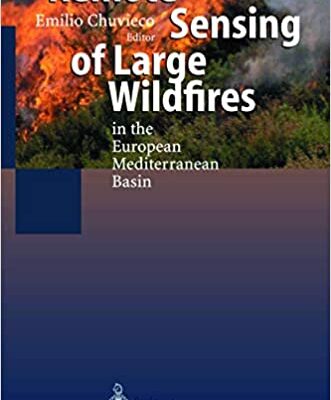
by Emilio Chuvieco (Editor)
The book gives a systematic review of the different applications of remote sensing and geographical information system techniques in research and management of forest fires. The authors have been involved in this topic of research for several years, resulting in more than 100 papers in highly rated journals and proceedings. The book also benefits from data generated within the Megafires project, founded under the DG-XII of the European Union. Most of the contributors to this book have been involved in the Megafires project, and therefore a clear integration of research and experience is provided. New data from fires affecting European countries between 1991 and 1997 are included as well as satellite images and auxiliary cartographic information.
1st Edition
by Guangxing Wang (Editor), Qihao Weng (Editor)
There are no reviews yet.